historic preservation / urban design
savannah mpc: historic resources, zoning, and advanced planning
savannah, georgia, usa
During my time at the Savannah Metropolitan Planning Commission, I served in a hybrid planning role that bridged current planning, zoning review, and long‑range/advanced planning. One of my key responsibilities was updating the historic resources inventory for the Streetcar Historic District—a grant‑funded effort to verify, correct, and modernize the district’s mapped resources. This included reviewing historic surveys, confirming architectural classifications, ensuring GIS accuracy, and aligning documentation with state and local preservation standards.
Beyond this project, I worked across multiple historic districts in Savannah, reviewing Certificates of Appropriateness, preparing staff reports, and presenting cases before preservation boards and planning commissions. My work extended into countywide planning as well, contributing to revitalization strategies for smaller Chatham County communities—projects that focused on walkability, public space improvements, and neighborhood‑scale design interventions.
As a hybrid planner, I reviewed site plans, zoning requests, and development proposals while also supporting long‑range initiatives that shaped future land‑use patterns. This role allowed me to operate at multiple scales—building‑level preservation, neighborhood revitalization, and countywide planning—while engaging deeply with Savannah’s rich historic fabric and its evolving urban needs.

cuyler‑brownville historic district: survey & brochure
savannah, georgia, usa
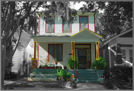
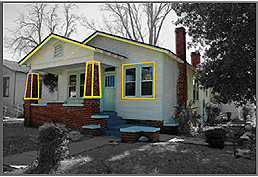
This brochure was created to highlight the historic richness of the Cuyler‑Brownville neighborhood and to share the results of a comprehensive architectural survey administered by the Savannah Metropolitan Planning Commission. The project identified all structures 40 years or older within the district, updating and expanding the neighborhood’s historic resource inventory for the first time since its 1994 National Register listing. Between 2018 and 2020, surveyors documented 983 buildings and one structure, adding them to the Georgia Natural, Archaeological, and Historic Resource GIS database and providing an updated snapshot of the district’s architectural character.
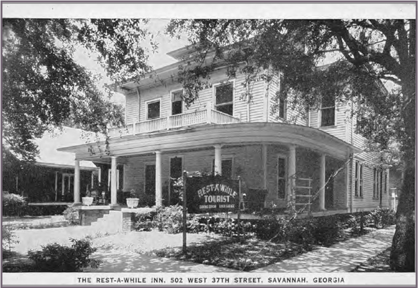
The brochure distills this extensive research into an accessible format, illustrating the neighborhood’s dominant architectural styles—particularly Craftsman and Colonial Revival—and mapping original versus current uses to better understand how the community has evolved. It also contextualizes Cuyler‑Brownville’s origins as a post–Civil War African American neighborhood shaped by self‑built institutions, from schools and churches to early tourist homes that supported local economic growth.
By combining historical narrative, architectural analysis, and survey data, the brochure serves as both an educational resource and a preservation tool—celebrating the cultural legacy of Cuyler‑Brownville while supporting ongoing planning and conservation efforts.

bridgend historic district: streetscape & riverfront revitalization
bridgend, wales, uk
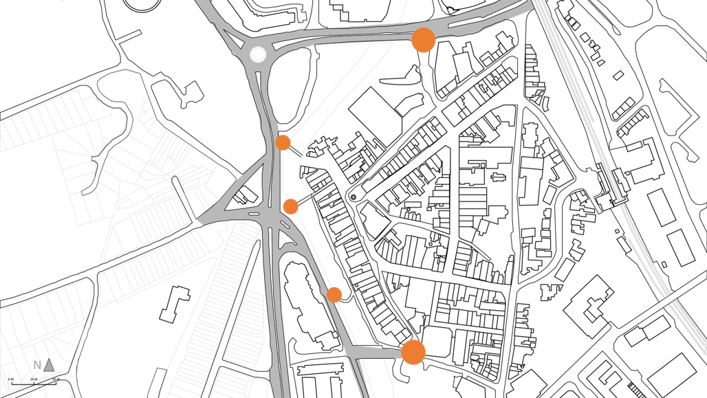
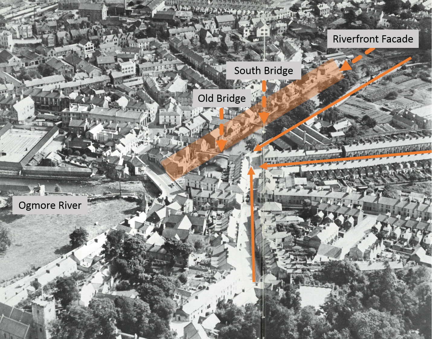
This study examines the historic town centre of Bridgend, Wales—an area rich in heritage yet challenged by declining activity, limited business hours, and a streetscape that no longer supports the vibrancy it once had. Anchored by the Ogmore River and a network of historic streets, the district contains centuries of architectural layers, from the fifteenth‑century stone bridge to listed buildings that once framed a thriving market town. Over time, infrastructural changes, canalization, and shifting commercial patterns have altered the fabric of the centre, leaving key gateways underutilized and the riverfront disconnected from daily life.
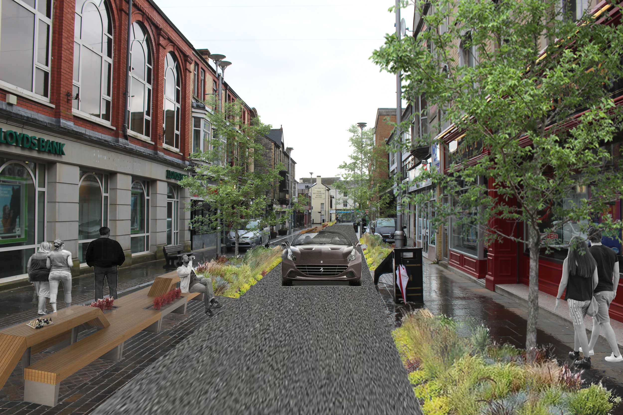
Through map analysis, historical research, case studies, and on‑site documentation, this project evaluates how the riverfront and streetscape can be reactivated to restore a strong sense of place. Drawing from the theories of Gordon Cullen and Jan Gehl, the report identifies opportunities to strengthen visual relationships, improve pedestrian experience, and reintroduce “staying activities” that encourage people to linger rather than pass through. Recommendations include rethinking the canal walls, activating river‑facing façades, enhancing gateways, reintroducing mixed‑use vibrancy, and redesigning streets to balance pedestrian comfort with strategic vehicle access.
The result is a comprehensive vision for a more connected, lively, and resilient Bridgend—one that honors its historic fabric while creating a welcoming environment for residents, visitors, and future growth.
-
As part of my work with the Savannah Metropolitan Planning Commission, I served as the staff reviewer for Certificates of Appropriateness (COAs) within the city’s historic districts, including the Streetcar Historic District. This example—prepared for a new construction proposal at 217 West 33rd Street—demonstrates the depth of analysis required to evaluate projects against both zoning regulations and historic preservation standards. My responsibilities included assessing visual compatibility, verifying compliance with the district’s design guidelines, reviewing materials and architectural details, and identifying conditions necessary for approval.
The report reflects the balance required in preservation planning: supporting contemporary development while protecting the historic character of the district. It also highlights my ability to interpret complex ordinances, coordinate with applicants, and prepare clear, actionable recommendations for the Historic Preservation Commission. This work was part of my broader role as a hybrid planner, where I engaged in zoning review, historic resource evaluation, and long‑range planning across multiple districts in Savannah and Chatham County. Click here, for the report.
-
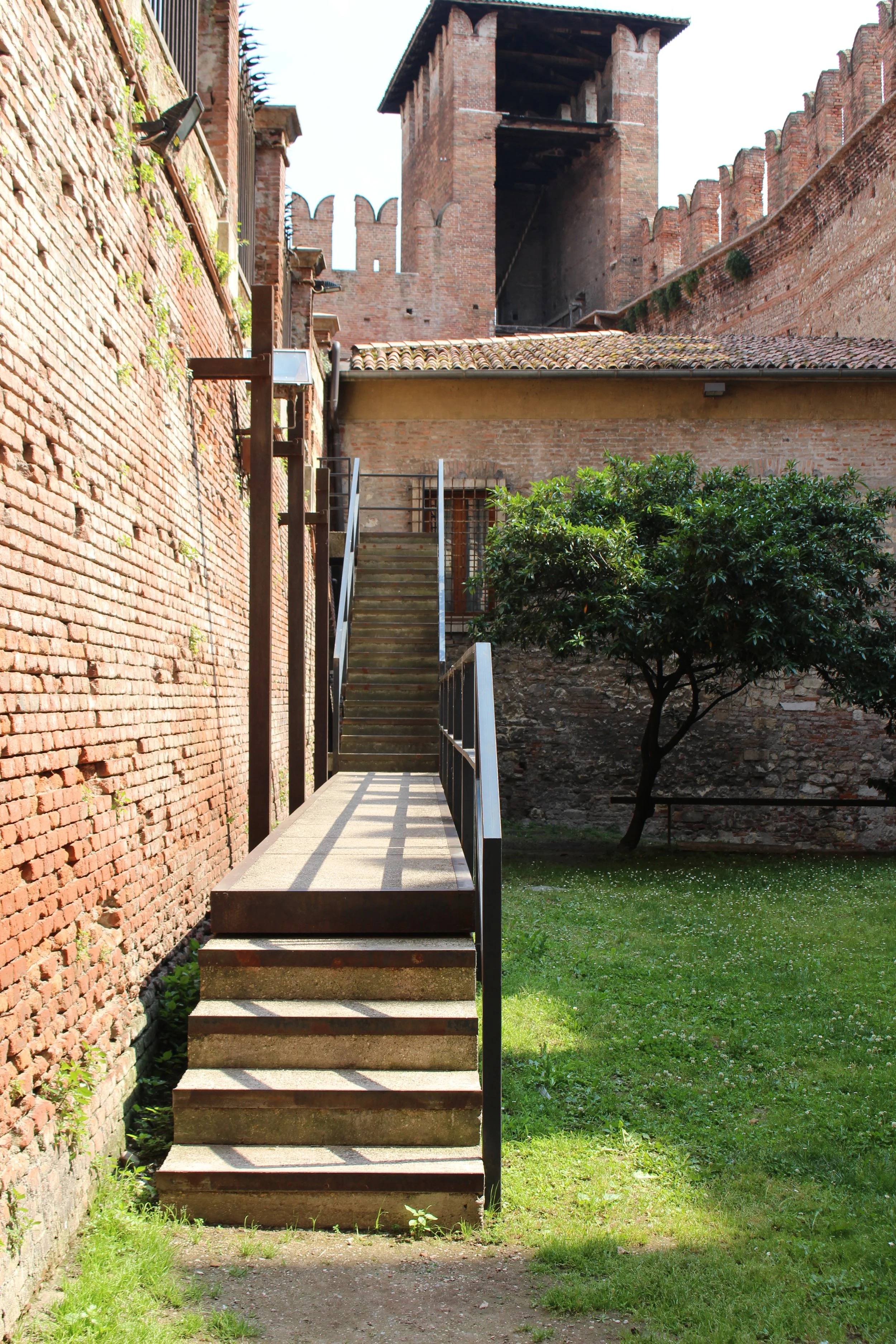
This two‑part essay explores the delicate balance between historic conservation and contemporary intervention through the lens of Carlo Scarpa’s work and the restoration of the Basilica San Zeno. Drawing from theorists such as John Ruskin, Gordon Cullen, and the ICOMOS guidelines, the study examines how architects and conservators navigate the tension between preserving original fabric and introducing new design elements.
Part I analyzes Scarpa’s interventions at Museo di Castelvecchio and Palazzo Querini Stampalia, highlighting how his layered approach—revealing history while inserting precise, modern details—can either harmonize with or challenge the existing context. The essay critiques the successes and frictions of Scarpa’s “new versus old” methodology, questioning where contemporary expression enhances heritage and where it risks overshadowing it.
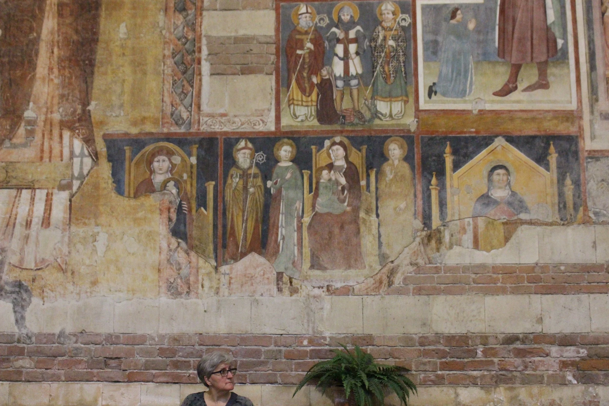
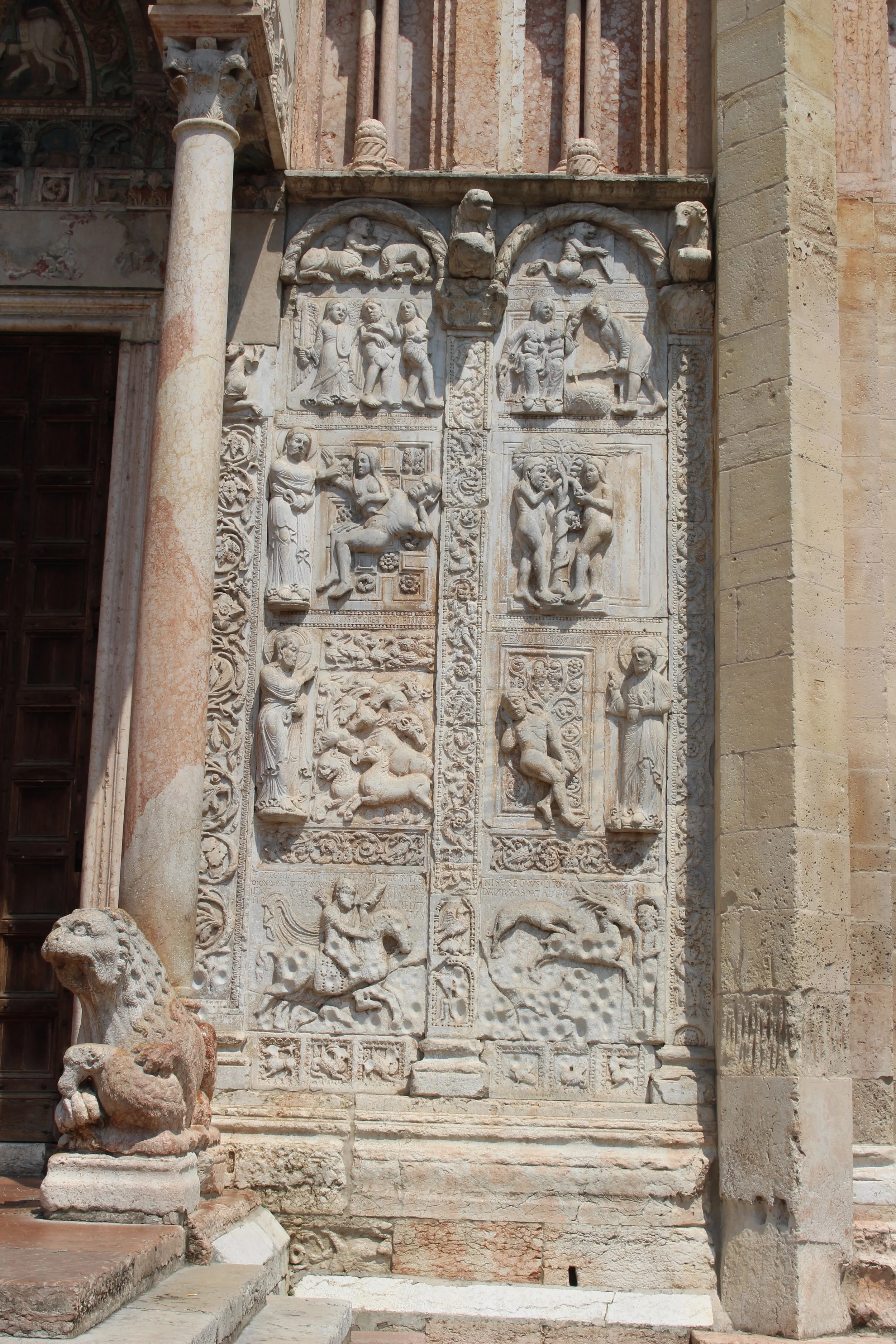
Part II evaluates the restoration of the Basilica San Zeno in Verona, comparing its methodologies to the 1993 ICOMOS guidelines. Through documentation of frescoes, altars, construction phases, and archaeological findings, the essay demonstrates how multidisciplinary expertise, careful material analysis, and long‑term management planning are essential to responsible conservation.
Together, the essays argue that meaningful preservation requires both respect for historic authenticity and thoughtful integration of contemporary techniques—ensuring that heritage sites remain culturally resonant, structurally sound, and accessible to future generations. Click here, for the report.
-
As part of my work with TerraXplorations, I contributed to the identification, evaluation, and documentation of historic resources for official state and federal records. Our team conducted field surveys, archival research, and architectural assessments to determine the historical significance of properties and ensure accurate reporting for compliance and preservation planning.
One example from this work includes the documentation of a one‑story, irregularly shaped residence originally built as an L‑shaped, half‑courtyard Ranch house. Through aerial analysis and on‑site investigation, we identified multiple additions—visible by 1992—that altered the building’s form and obscured its architectural style. The associated barn, located roughly 150 feet northeast of the residence, was recorded as a two‑story, rectangular structure with a gambrel and shed roof clad in sheet metal, and exterior materials ranging from vertical wood planks to corrugated metal.
This survey, like many others I completed, involved producing clear, accurate, and professionally formatted records that contribute to state historic inventories and guide future planning decisions. My work supported TerraXplorations’ mission to document cultural resources with precision, contextual understanding, and respect for the historical landscape. Click here, for the report.
norton house: energy use of historic buildings
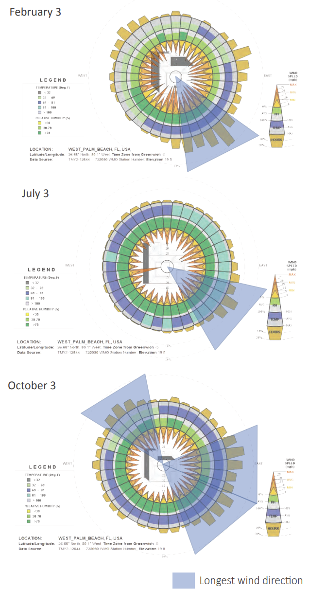
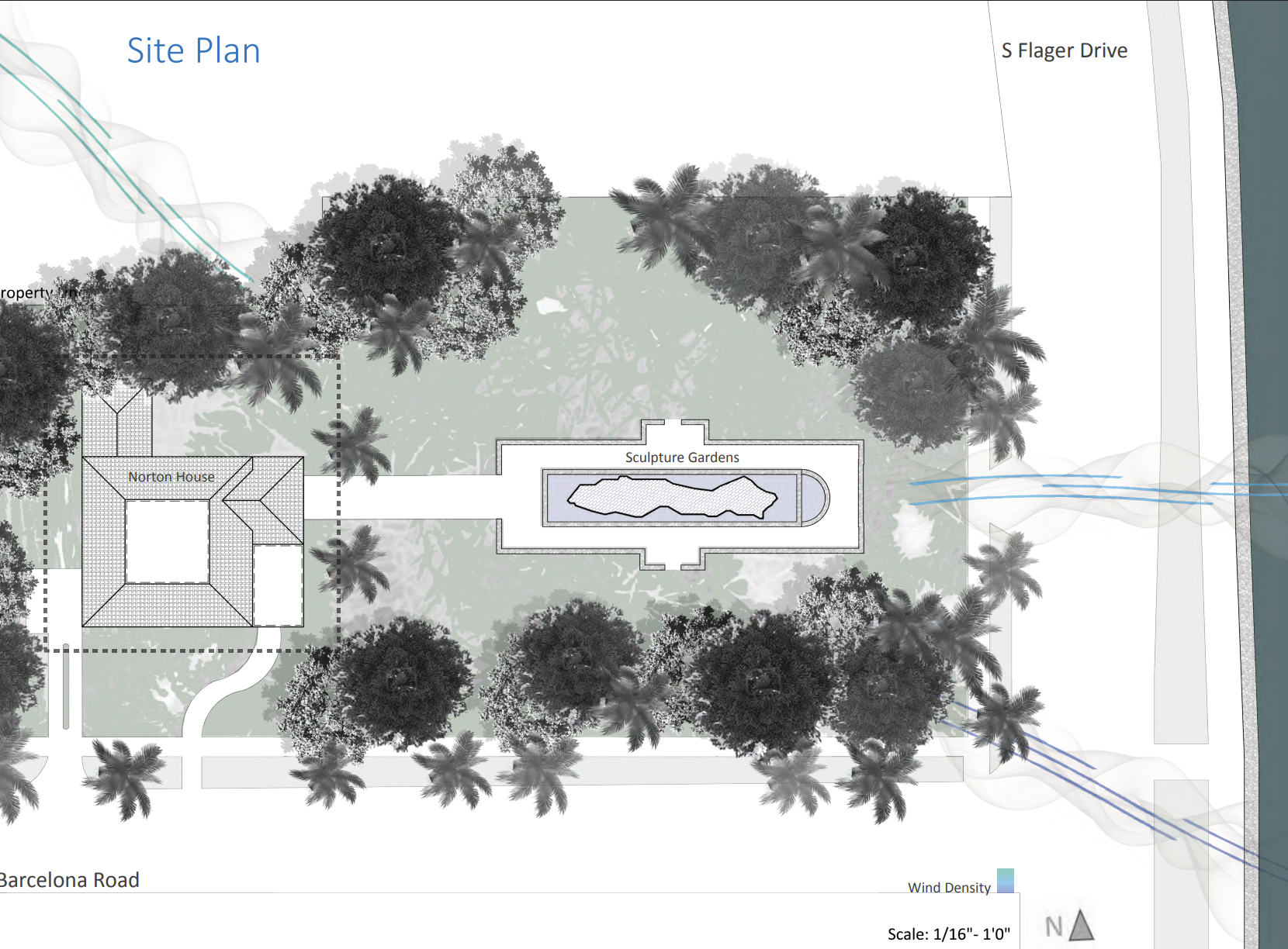
This report analyzes the Norton House—an important 1925 Monterey‑style landmark in West Palm Beach—and explores how historic preservation and environmental performance can work hand in hand. Through climate analysis, sun‑shading studies, wind mapping, thermal‑transmittance calculations, and WUFI simulations, the project evaluates how the building envelope performs in Florida’s hot‑humid Zone 1 climate. The research identifies which passive design strategies were embedded in the home’s original construction and proposes new, low‑impact interventions to improve comfort and reduce energy use without compromising historic integrity.
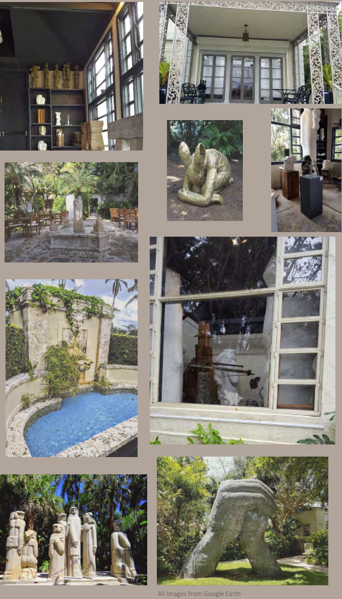
Part two expands the study to building services, examining how the Norton House functions today as the Ann Norton Sculpture Gardens museum. It proposes strategies such as stack‑effect ventilation, optimized A/C scheduling, and adaptive reuse approaches that prepare the site for long‑term climate challenges—including sea‑level rise. The project ultimately demonstrates how thoughtful analysis and sensitive upgrades can protect a historic structure while supporting its contemporary cultural role.